Space At Sea
A correction about the SpaceX launch numbers I provided in my last analysis: I initially stated that 101 of 115 Falcon launches were for Starlink. That’s incorrect. It was 78 out of 115 at the time–still high, but not as significant a share as I reported. For those wondering, I double-counted my database categories of launches with Starlink Cellular and Starlink regular satellites. There were regular Starlinks on those cellular launches, so…66% of SpaceX’s launches were for Starlink only, not the 88% I initially counted. While it still points to a future in which SpaceX’s launches will increasingly be for its purposes, it’s not as much as I thought.
Thank you to Yoann Moguer (on Twitter/X) for pointing out the discrepancy.
With the corrections provided and the thank you given, here is an update on SpaceX’s launch numbers from my last article. With November at an end, SpaceX decided to launch the most Falcons in a month: 16. That is one more than the 15 I had thought it might do. It may mean that December will be nearly as busy, so maybe my estimate of 13 Falcon 9 launches in December will also be eclipsed. It looks like SpaceX is aiming for 15.
Very early on, SpaceX made it clear that it wanted to launch more often per year, and increasing its average monthly launch cadence will do that. However, some probably assumed that the desired goal translated to SpaceX launching more customer launches.
Internet on a Ship–for a Price
My family and I were on a cruise last week. It was fun, the food was plentiful, the excursions were interesting, and it included space. At least, space was involved during a few days of the cruise on a Royal Caribbean ship.
We relied heavily on the ship’s wi-fi for information, from itinerary updates to messaging among family members. The network signal seemed pretty strong throughout the ship. I occasionally bought a day’s worth of internet access through this network. And yes, I know there are weekly packages, but we planned to wander off the ship through other countries on excursions for a few of the cruise’s days. Since I have Google Fi, I would use the local cell networks for internet access at no extra cost (about $30/month for three gigs–not tremendous, but good enough).
Twenty-four hours of internet for one device cost about $26–nearly as much as a month’s worth of Fi. But, to give credit to Royal Caribbean, it worked. I registered my phone as the device used for internet access, then tethered my laptop through it to get work done. It worked very well, and if there was any latency, I didn’t register it.
I wasn’t playing games or streaming (aside from a YouTube video now and then); I used it for texting, internet browsing, spreadsheet updates, and writing. But, I experienced no slowdowns and saw no evidence of network congestion. It was, weirdly, more responsive than switching through the ship’s TV channels.
It's very nice to have that in the middle of the ocean. The world was my oyster. And by oyster, I mean my office (image below).
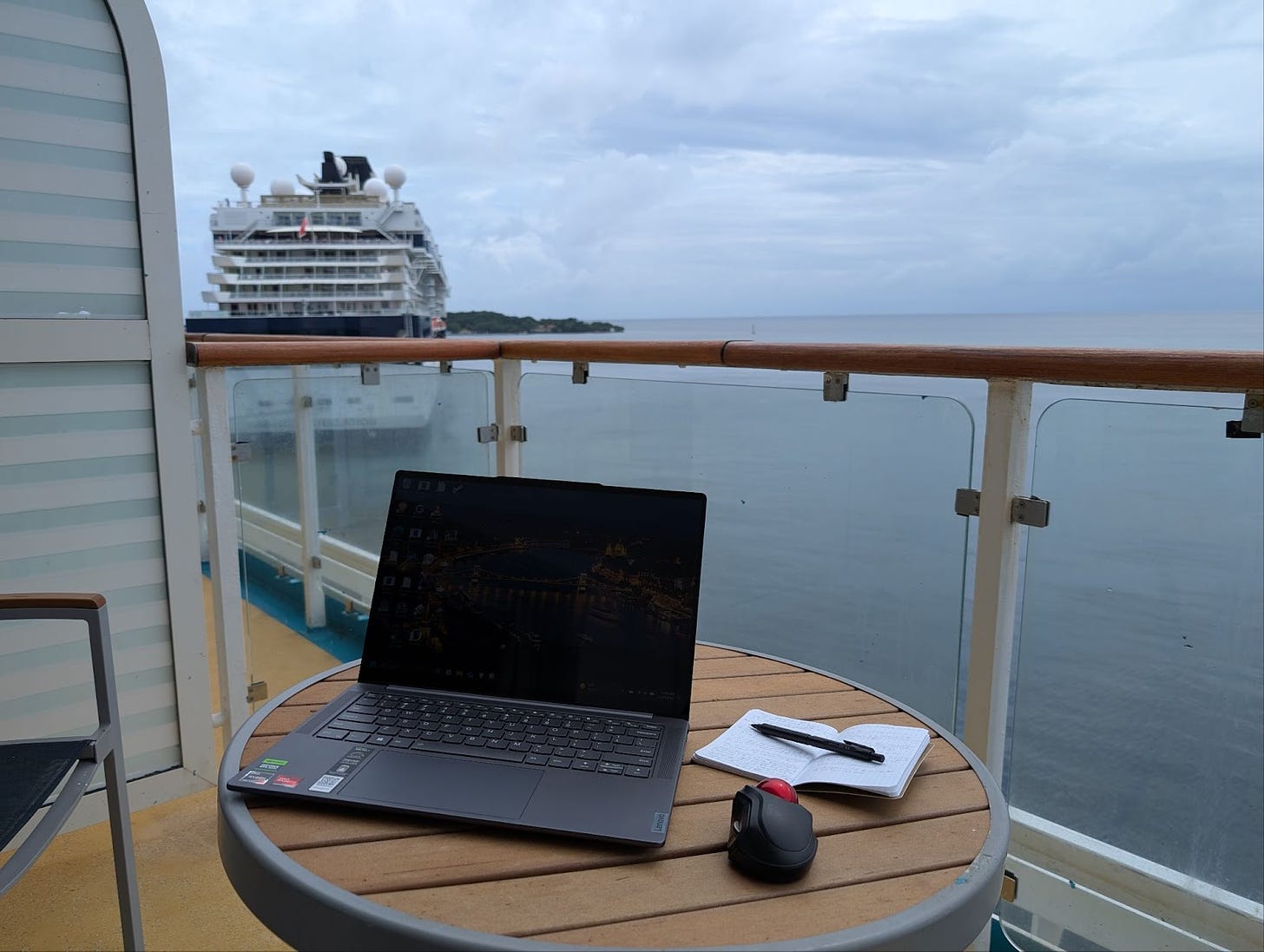
Royal Caribbean offers internet access through its VOOM service, which is supposed to use Starlink to connect the ship to the rest of the world. It was my first time using Starlink’s service, but it worked as expected. The service has been around for a little over four years and has had the time for SpaceX to massage some reliability into it, primarily by adding thousands of satellites to the constellation.
That’s four years during which no other space-based internet competitor has joined Starlink in LEO.
So, yes, I bought internet access while floating across the ocean, and it worked. Maybe interesting, but not surprising. But there’s more.
Playing “What’s that Ship?”
While wandering about the outside decks, I saw ships nearby and on the horizon. My wife asked me if I knew what type of ship the closest one was. It looked like a container ship, but I knew of a way to verify that assumption. You see, I had the internet and was determined to squeeze as much value out of those $26 as possible.
I opened my phone browser and went to marinetraffic.com. If you do this on a desktop or laptop, Marine Traffic’s page opens up to a map like the one below:
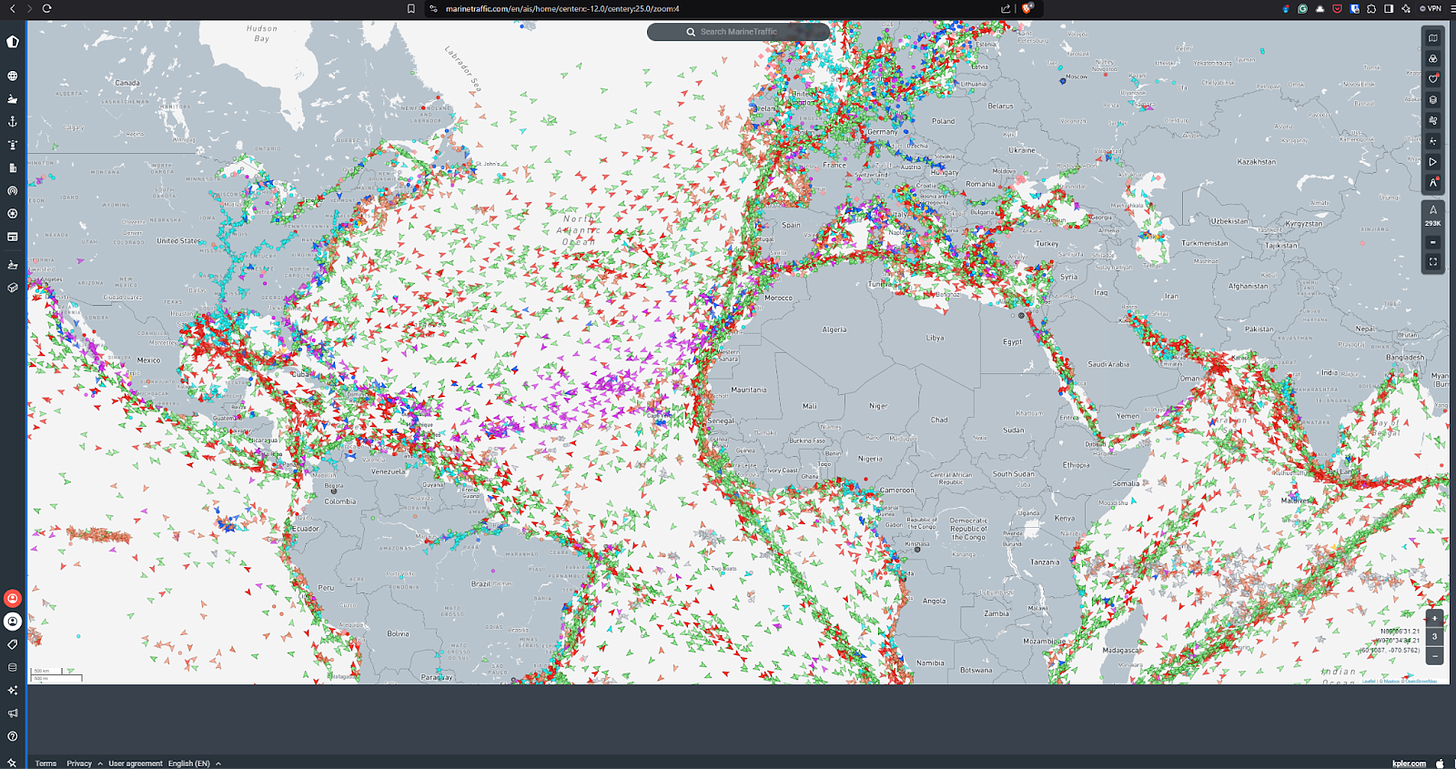
Fortunately, the mobile site isn’t quite as large but provides helpful information. Also, the Gulf is quite busy.
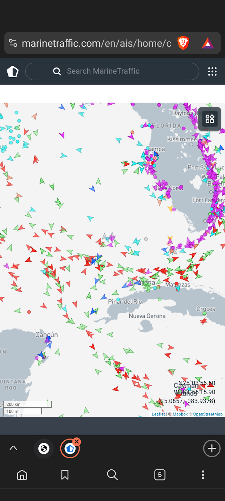
Each of those colored arrowheads represents some kind of ship currently moving through the water. Tankers, cargo ships, private vessels, etc., the site lets you know it’s monitoring about 293,000 vessels (middle right of the page, where 293K appears). The site monitors ships actively through the automatic identification system (AIS). AIS transmits automatically, with no human interaction, and all the time unless the ship operator switches it off, which is allowed under certain conditions.
The AIS on a ship is promiscuous, wirelessly broadcasting much information to shore stations, ships, satellites, and other AIS relays. The broadcasted information contains the direction of the ship’s heading, its current location, its identification, its speed, etc. That current location (position) is also calculated using space systems, by the way. GPS coordinates are included in AIS messages.
AIS is a navigational aid. However, it helps keep ships from running into each other, so those close to each other with AIS automatically provide data. The received data can be plotted on a ship’s radar scope, giving the crew accurate information on the location of vessels nearby (as well as their IDs and ship type). As seen on Marine Traffic’s site, hundreds of thousands of ships know where they are (and the position of ships close to them) because of AIS.
It so happens that I can do the same thing on my smartphone. I don’t have AIS, but a network connection works just as well. With it and Marinetraffic.com, I found the ship we were on. Then, I decided which direction from our ship was the closest one. In this case, this was the ship we saw from the deck:
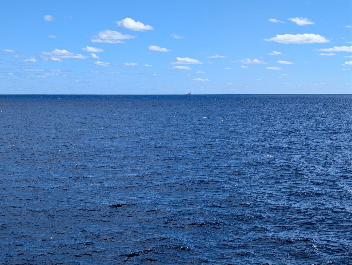
While it might be hard to see on the screen, my eyes discerned a white superstructure atop a red or orange hull. I tapped on the arrowhead on my screen corresponding to the ship's direction. The result was nifty:
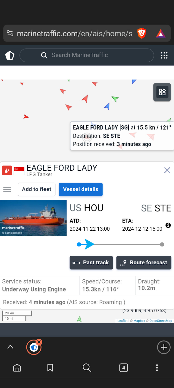
The picture of the Eagle Ford Lady looks pretty much like the ship I saw from the deck. Of course, there are probably quite a few vessels with the same color scheme–but none were directly ahead of our ship as the Eagle Ford Lady was. There’s also a lot of other information, such as when it left a port and the port it’s heading to. That it’s a petroleum gas tanker (not the container ship I initially thought). The national flag it sails under (Singapore), speed, direction, etc. Also, the position was updated three minutes before I brought up the ship’s information, probably from the ship itself (I think that’s what “Roaming” means–it is difficult to find the term concerning AIS).
The “Vessel Details” button reveals a lot more information. MarineTraffic.com’s subscribers get even more detail. The fact that this information shows up on my phone means that AIS is also being shunted to land through satellite or shore station and injected into the internet.
But I just wanted to get my $26 worth to identify the ship, so no subscription was necessary. I can’t say that my spouse was impressed that I identified the ship this way, but she didn’t shun me, either, so… I was entertained, which was the second-most important part of the AIS exercise.
There are layers of space services in the most unexpected places. GPS’ ubiquity makes it almost forgettable, but it’s tremendously helpful for shipping. AIS, whether relayed from ship-to-ship or ship-to-satellite-to-ship, is useful and appears easy for non-sailors like myself to look at and use. And internet relay satellites, like those from Starlink, help get the data from land sources to those on ships–effortlessly. Hopefully, competitors will come forward and help make that service cheaper in time.
All of it adds up to making life better for humans on Earth, which is the point of putting these tools in space and everywhere else, whether for on-time shipping with little trouble or cruising in the Gulf for pleasure.
If you liked this analysis (or any others from Ill-Defined Space), please share it. I also appreciate any donations (I like taking my family out every now and then). For the subscribers who have donated—THANK YOU from me and my family!!
Either or neither, please feel free to share this post!


Comments ()